
C H A P T E R
N ° 38
Maritime Ports (Part 3)
Today’s article will be the third, and the last, of three articles focused on the relation between space weather and maritime ports.
Combined, the three articles will explore maritime ports as a critical infrastructure (CI), the “system of systems” design, and the anticipated ‘mega disaster’ scenario. Additionally, they will look closer at the connection between seaports and the energy sector and space infrastructure. Moreover, they will discuss the notion of cascading risks, focused on the combination of space weather, the ‘system of systems’ design, and maritime ports. Lastly, they will consider how space weather resilience can plays a significant role within maritime resilience.
In this article; C H A P T E R N ° 38 Maritime Ports (Part 3), the following topics will be explored: Space weather and satellites, cascading risks, and space weather resilience.
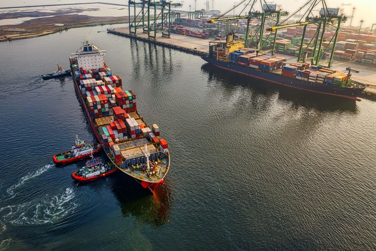
Image Credit: VS&B Containers Group.
Space weather and satellites
The Position, Navigation and Timing (PNT) systems require a receivable and accurate ranging signal operating with full integrity, meaning within the accepted ‘nominal accuracy bounds’. However, there are many things that can impact the integrity of satellite signals, one of which is space weather.
Space weather is a natural hazard that can interfere with the transmission of the data from a satellite to receivers on Earth. Satellites use a wide range of radio and microwave frequencies to send and receive data. These have to travel through the Earth’s atmosphere, specifically the ionospheric region. However, during certain space weather events, this natural hazard can cause ionospheric fluctuations turning parts of the atmosphere into a very hazardous environment for radio and microwaves. This hazardous environment can cause complete blockage of satellite signal transmissions, and affect the accuracy and reliability of satellite signals, impacting safe navigation, especially in narrow or crowded waterways near ports, and seaport operations.

Image Credit: BAE Systems: Cartoon showing NOAA’s new observatory for space weather, the SWFO-L1 mission launched in the fall of 2025.
The ionospheric fluctuations are created through solar activities such as solar flares, Coronal Mass Ejections (CMEs), and high-speed solar wind streams (HSS) increasing ionization and alter electric fields and currents in the ionosphere. These solar activities can cause changes in the ionosphere’s electron density, effecting radio wave propagation and signals. This is done by Earth-directed solar activity bombarding the ionosphere with high-energy particles and radiation, increasing the number of charged particles (electrons) in a given volume. This increase in ionization leads to rapid and significant changes in the ionosphere's electron density, both in time and space. With a dense ionized ionospheric region, this part of the atmosphere is able to deflect or absorb incoming radio waves (i.e., satellite signals), causing the satellite signals to either provide sparse data or to never reach the ground receivers.
Due to the interaction between solar activities, the Earth’ atmosphere, and radio waves, any type of dependency on satellite services would pose a certain level of risk and vulnerability to the system it is utilized in. In regards to maritime ports, a dependency on the Position, Navigation and Timing (PNT) systems and with that the Global Navigation Satellite Systems (GNSS), thus, creates a vulnerability and risk, within the maritime port to space weather impact. The risks and vulnerabilities regarding space weathers interaction with communication services used at, for example, maritime ports are, therefore, very similar.
Space weather affects maritime communication by causing complete blackouts or disrupting radio frequencies used for communication. Solar activities like solar flares can cause ‘radio blackouts’ by ionizing the lower atmosphere, absorbing High-Frequency (HF) radio waves, while geomagnetic storms can disturb the ionosphere, causing unpredictable signal paths and affecting both High-Frequency (HF) and satellite signals. The absorption and deflection of satellite signals can lead to unreliable or lost contact with vessels at sea, creating operational and safety risks, especially at high latitudes where ionospheric disturbances are more frequent and intense.
Here are some of the consequences associated with a loss of communication within maritime ports:
Operational risks: Disrupted communication can lead to unreliable contact between vessels and ports, affecting scheduling, cargo handling, and emergency response coordination.
Safety concerns: At sea, reliable communication is critical for safety. Disruptions can be particularly dangerous during emergencies, potentially cutting off contact between a vessel and shore-based support. A complete loss of signals from the Automatic Identification System (AIS), which transmit vessel positions and data through Very High-Frequency (VHF) radio, can lead to gaps in real-time vessel tracking. Tracking maritime vessels is crucial for a variety of things, such as enhancing safety and security, improving operational efficiency, ensuring regulatory compliance, and protecting the environment. It allows for real-time monitoring of vessel positions to prevent collisions, piracy, and other hazards, whilst additionally enabling businesses to optimize routes, manage supply chains, and adhere to international standards for navigation and environmental protection. Furthermore, a loss of the Automatic Identification System (AIS) additionally means a lack of or a compromise in accurate situational awareness. Situational awareness on maritime vessels is crucial for tasks like collision avoidance, navigating safely in adverse weather, and performing operations. It directly contributes to the safety of crew, the vessel, and the environment.
One thing that is important to recognize is, that not all communication technologies are dependent on the ionosphere to function, yet many are either dependent on or influenced by it. Technologies like shortwave radio (High-Frequency (HF) and Medium Frequency (MF)) are dependent on the ionosphere to reflect signals back to Earth for long-distance communication. Other systems, including the Global Positioning System (GPS) and many satellite communications, are simply influenced by it as their signals must pass through the ionosphere, and changes in its density can cause signal delay, loss, and inaccuracies.

Image Credit: Marine Digital.

Image Credit: Marine Digital.
Cascading risks
As mentioned in the beginning, space weather has been argued to have the potential to influence and push towards a ‘mega disaster’ scenario or similar scenarios. A significant reason for this is the way that critical infrastructure (CI) at a national and global level is build, and their increasing dependency on the energy sector and advanced technologies that are dependent on the combination of the energy sector and the space sector.
Critical infrastructure (CI) is characterized by a complex “system of systems” design, wherein the operation of one sector heavily depends on the functionality of one or more other sectors which increases the possibility of cascading risks. In addition to the space sector, another sector that the maritime sector is dependent on in order to function properly is the energy sector. However, the energy sector is not immune to space weather impact.
Space weather can cause multiple issues for the energy sector, one of which is Geomagnetically Induced Currents (GICs) that can damage electrical grids, potentially leading to power outages at the maritime ports. Power outages at maritime ports can cause operational disruptions, safety risks, and cargo damage, as they can halt critical equipment like cranes and affect navigation and communication systems.
“ Geomagnetically Induced Currents (GICs) are electrical currents that flow in long, grounded conductors like power grids and pipelines, caused by rapid changes in Earth's magnetic field during geomagnetic disturbances. These currents are induced by the electric fields that are generated by the fluctuating magnetic fields from space weather events, such as solar flares and coronal mass ejections. If large enough, GICs can cause transformers to overheat, damage equipment, and potentially lead to widespread power outages. ”
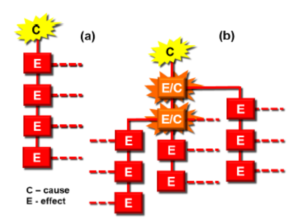
Image Credit: Alexander & Pescaroli 2015: (a) liner path of events in disaster and, (b) non-linear path of cascading, including amplification and subsidiary disasters.
The combined effects of communication issues or complete blackouts, navigation system failures, and potential power outages create a highly complex situation, whereby most of the critical maritime ports capabilities are degraded. A damage or complete shutdown of important maritime services can create ripple effects within its own sector, leading to significant disruptions. For example; significant delays or a disruption in vessel traffic into and out of ports at a single port can have a ripple effect on subsequent ports, consequently requiring operations to adjust schedules and potentially leading to cargo accumulations.
However, the ripple effect of loss of power, communication, and/or positioning, navigation and timing capabilities does not only affect the maritime sector. All critical infrastructure (CI) could simulations be impacted, highlighting the interdependencies between critical infrastructure (CI), and leading to the suggested ‘mega disaster’ scenario.
Space weather resilience
A lot of the world’s welfare has been produced or is facilitated by sea ports and their related activities. They are a vital component in the maritime network and a critical system in global trade and supply chains facilitating approximately 80% of the world’s trade.
The sectors most at risk from space weather impact are the energy, communication, and transportation sectors, and satellites (space sector). All of which plays a significant role within the maritime sector and maritime ports. Space weather resilience efforts are, therefore, an important part of maritime resilience and will increasingly play a role with the increasement of dependency on advanced systems within the maritime sector. Understanding the interaction between space weather and the maritime sector is important in order to minimize the potential risks associated with space weather impact on the maritime systems, some of which are the following:
Solar flares: Solar flares can cause sudden radio blackouts by ionizing the atmosphere, which blocks or degrade High-Frequency (HF) radio signals used for long-distance communication, causing communication issues between maritime ports and vessels and vessel-to-vessel.
Solar Energetic Particles (SEPs): Solar energetic particles (SEPs) can damage or cause malfunctions in satellites and satellite-based systems, affecting services like satellite communication and Global Positioning System (GPS) navigation that are crucial for port operations and ship tracking.
Ionospheric disturbances: Ionospheric disturbances can scatter or block Global Positioning System (GPS) signals, leading to errors in navigation and positioning for ships relying on these systems when, for example, entering maritime ports.
Solar flares, Coronal Mass Ejections (CMEs), and Solar Energetic Particles (SEPs): Different types of solar activity, such as solar flares, Coronal Mass Ejections (CMEs), and Solar Energetic Particles (SEPs), can affect the satellites used for Satellite-based Automatic Identification System (S-AIS), potentially hindering the tracking of vessels at sea. A loss of Automatic Identification System (AIS) capabilities decreases the maritime vessels situational awareness capabilities and causes challenges within emergency and disaster management.
Source
Fiori, Robyn (2022): “Development of space weather services to inform maritime users of space weather events affecting high frequency radio communication”. 44th COSPAR Scientific Assembly. Held 16-24 July, 2022. Volume 44. Online at https://www.cosparathens2022.org/. Abstract PSW.1-0001-22. Pp. 3435.
Grant, Alan; Shaw, George (2012): “The effect of space weather on maritime aids-to-navigation service provision”. Annual of Navigation. Vol. 19(1). DOI: https://doi.org/10.2478/v10367-012-0005-9?urlappend=%3Futm_source%3Dresearchgate
Xue Dabin et al. (2024): “Space weather effects on transportation systems: A review of current understanding and future outlook”. Advancing Earth and Space Science (AGU). Volume 22, Issue 12. DOI: https://doi.org/10.1029/2024SW004055
Geerlings, H., Kuipers, B. and Zuidwijk, R. (2018). Introduction. In: Geerlings, H., Kuipers, B. and Zuidwijkm R. (eds.) Ports and Networks: Strategies, Operations and Perspectives. Routledge: Oxford.
OECD (2008): “Protection of Critical Infrastructure and the Role of Investment Policies Relating to National Security”.
Schlegelmilch, J. (2020): “Rethinking Readiness: A Brief Guide to Twenty-First Century Megadisasters”. New York: Columbia University Press.
Parkinson, B. W. et al. (2021): “Introduction, Early History and Assuring PNT (PTA)”. In: Morton, Y. J., Van Digglen, F., Spilker Jr, J. J. and Parkinson, B. W. (eds.) Position, Navigation, and Timing Technologies in the 21st Century: Integrated Satellite Navigation, Sensor Systems, and Civil Applications (Volume 1). IEEE Press: New Jersey
Yang, Y., Zhong, M., Yao, H., Yu, F., Fu, X. and Postolache, O. (2018): “Internet of Things for Smart Ports: Technologies and Challenges”. IEEE Instrumentation and Measurement Magazine, February.
Jayavardhana, G., Rajkumar, B., Slaven, M. and Marimuthu, P. (2013): “Internet of things (IoT): a vision, architectural elements, and future directions”. Elsevier Future Generation Computer Systems, 29 (7), pp. 1645-1660.
Ishii, Mamoru et al. (2024): “Space weather impact on radio communication and navigation”. ELSEVIER. Advances in Space Research. DOI: https://doi.org/10.1016/j.asr.2024.01.043
NOAA (n.d.): “HF Radio communication”. https://www.swpc.noaa.gov/impacts/hf-radio-communications#:~:text=Space%20weather%20can%20impact%20HF%20radio%20communication,enhanced%20D%2Dlayer%20that%20blocks%20HF%20radio%20communication.
Danish Maritime Authority (n.d.): “AIS data”. https://www.dma.dk/safety-at-sea/navigational-information/ais-data
Hansen, Nicholas (2023): “Situational Awareness for autonomous marine vessels”. Technical University of Denmark (DTU). https://backend.orbit.dtu.dk/ws/portalfiles/portal/338331238/PhD_thesis_260_sider_-_76_farvede.pdf
WindWard (n.d.): “Automatic Identification Systems (AIS)”. https://windward.ai/glossary/what-is-automatic-identification-systems-ais/
SKYFI (n.d.): “Vessel tracking: keeping ships on course with moderns technology”. https://skyfi.com/en/blog/vessel-tracking-keeping-ships
Maritime Fairtrade (2024): “Navigating safety: importance of martine vessel tracking systems”. https://maritimefairtrade.org/navigating-safety-importance-of-marine-vessel-tracking-systems/
Maljković, Mislav et al. (2022): ”Situational Awareness from the master point of view and importance of factors that influence it”. ResearchGate. Conference ICTS 2022. https://www.researchgate.net/publication/361735423_SITUATIONAL_AWARENES_FROM_THE_MASTER_POINT_OF_VIEW_AND_IMPORTANCE_OF_FACTORS_THAT_INFLUENCE_IT