
C H A P T E R
N ° 40
Submarines (Part 1)
Submarines are commonly known as military vessels. However, in today’s society, they additionally serve as vital analogue environments for space missions, used to testing human endurance, isolation, and life support systems (e.g., CO2 scrubbers) in extreme underwater environments, directly informing future explorations on the Moon, Mars, and beyond. Furthermore, they are also utilized to test autonomous navigation and remote sensing. However, in order to enable this type of research, they heavily rely on services provided by, for example, the Global Navigation Satellite System (GNSS) (Global Positioning System (GPS)) and satellite communication services. In essence, whilst some submarines are utilized as military vessels, others are used as laboratories using space-derived technology and valuable testbeds for the human and technological challenges of space exploration.
“ An analogue environment is a real place on Earth with conditions (geological, environmental, or biological) similar to a target destination, like Mars or the Moon, used for studying planetary processes, testing space technology and protocols, and training astronauts for space exploration. “
Today’s article will be the first of two articles focused on the relation between space weather and submarines. Combined the articles will explore the impact of space weather on the submarines, looking closer at the interdependencies between critical infrastructure and the risks and vulnerabilities they pose to submarines
In this article, we will start by looking closer at the relation between space weather, critical space infrastructure, and submarines.
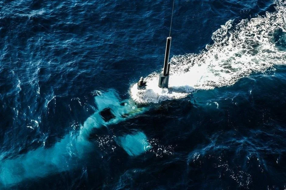
Image Credit: NavalPost: U-212 Class Submarine.
Direct and indirect effects
The ocean and hull provide substantial shielding from the direct radiation and magnetic flux from space weather, thus, making the submarines’ internal electronics largely safe from direct space weather affects. However, similarly to other maritime vessels, submarines rely on other critical infrastructures, making space weather primarily effect submarines indirectly through their dependency on critical infrastructures.
Submarines rely heavily on terrestrial (ground-based) and space systems in order to properly function, some of which are the energy sector and critical space infrastructure (satellite services).
Submarines and space infrastructure
Submarines use space infrastructure primarily through satellite communication, for global connectivity, and navigation, using services such as the Global Positioning System (GPS) and inertial navigation updates.
“ Inertial navigation (INS) is a self-contained way to track an object's position, velocity, and orientation without external signals, using internal sensors (gyroscopes for rotation, accelerometers for linear motion) to measure changes from a known starting point, essentially "dead reckoning" its path over time. “
Depending on what orbital class a satellite is launched into, the radiation exposure levels and, thus, the impact from space weather may differ. This can be due to the location of the orbital class compared to the Van Allen Belts and/or the Sun’s 11-year solar cycle. Modern commercial satellites often share some similar features. This means, that agencies and companies repeatedly experience the same type of impact on different satellites.
The near-Earth space radiation environment is mostly dominated by Galactic Cosmic Rays (GCRs) originating from supernova. These can cause multiple issues to satellites. However, space weather can shorten the time frame wherefrom these issues can occur and, additionally, their likelihood/the risk of them occurring. Issues often seen caused by space weather are: performance issues, blackouts, and complete shutdowns.

Image Credit: NASA: Cartoon of the Van Allen Belts and orbital satellite classes.
Communication
Submarines use different communication services depending on whether they are underwater or near the surface. When near the surface, they rely on satellites for reliable, secure, high-capacity/bandwidth communication, or antenna buoy to send data and receive updates, as radio waves do not penetrate deep water.
“ An antenna buoy is a floating marine marker equipped with radio/communication gear to transmit data or signals from the sea (like weather, ocean conditions, or submarine communication) back to shore or other vessels, serving as a mobile communication node or sensor platform. “
When underwater, they rely on Military SATCOM (e.g., Ultra High Frequency (UHF) and Extremely High Frequency (EHF) in the U.S. Navy’s SSIXS) for secure high-quality voice, data, and internet. Additionally, Very Low Radio Frequency (VLF) is used for deep-sea communication as its radio waves penetrate water. Submarines use this wavelength for one-way messages when submerged. The Very Low Radio Frequency (VLF) bandwidth is usually considered a weak signal band for bandwidth but its signals are powerful and travel extremely far due to long wavelengths, making it great for submarines.
The difference between, Very Low Radio Frequency (VLF) and Military SATCOM is, that the latter offers greater flexibility and bandwidth, yet requires the submarines to be near the surface, making them vulnerable to counterparts, whereas the first one enables communication under water. However, both services are enabled by satellites.
“ The U.S. Navy's SSIXS stands for ‘Submarine Satellite Information Exchange Sub-System’, a crucial UHF satellite communication system that dramatically improved message exchange with submarines by allowing them to receive large amounts of data quickly, moving them from slow VLF broadcasts to high-speed satellite links, enhancing stealth and operational speed. “
Solar activities like Coronal Mass Ejections (CMEs) can create geomagnetic storms causing ionospheric disturbances. The Coronal Mass Ejection (CME) can send charged particles that disturb the ionosphere, causing radio noise, signal scattering, and satellite signal degradation, making underwater communication unreliable. A disruption or full loss (blackout) of High-Frequency (HF) and Very-High-Frequency (VHF) radio which are often used by submarines can affect vital command, control, and data links between submarines (at periscope depth), and command centers.
Navigation
Submarines use different techniques for navigation depending on whether they are underwater or near the surface. When underwater they navigate using a primary Inertial Navigation System (INS), which continuously calculates position by measuring every turn, acceleration, and speed from its last known location, using stable gyroscopes and accelerometers. This is supplemented by the Doppler Velocity Logs (DVLs) which measures speed over the seafloor, adding precise velocity data to the Inertial Navigation System (INS). Additionally, submarines use fathometers to help map the ocean floor, comparing it to detailed charts for position confirmation.
“ A fathometer is an echo-sounding device using sonar to measure water depth by timing sound wave returns, forming the basis of modern seafloor mapping, a comprehensive process using advanced sonar (like multibeam) and satellite tech to create detailed 3D maps of the ocean floor for navigation, science, and resource management. “
When near the surface, submarines use the Global Positioning System (GPS) as the primary method for precise location fixes when the submarine raises its mast to periscope depth, as the Global Positioning System (GPS) signals do not penetrate water. Older systems, such as LORAN-C, are sometimes additionally used to provide navigation updates. LORAN is an old navigation system using fixed radio transmitters to help vessels and aircraft to find their position by measuring the time difference of received signals, providing long-range, accurate location. It is a land-based alternative to satellites like the Global Positioning System (GPS).
Solar activities like solar flares and Coronal Mass Ejections (CMEs) causing disturbances in the ionosphere can disrupt the Global Navigation Satellite System (GNSS) and, thus, the Global Positioning System (GPS) signals, impacting precise positioning (errors), leading to unreliable positioning data. The Global Navigation Satellite System (GNSS) is crucial for both surface and submerged operations as it is critical for things such as navigation, timing, collision avoidance, and maintaining operational awareness for surface vessels supporting submarines. The disturbances in the ionosphere caused by space weather interferes with the satellite signals, reducing accuracy or making them unusable, which is a critical issue for precise navigation.
Like surface vessels, submarines use the Automatic Identification System (AIS), a Very-High-Frequency (VHF) radio-based marine navigation and collision avoidance tool that allows maritime vessels and shore stations to automatically exchange real-time data like position, identity, course, speed, and destination. This enhances safety by letting vessels “see” each other on electronic charts and radar. During space weather events, there is a risk of system failure and gaps in data, as it relies on Very-High-Frequency (VHF) radio, leading to gaps in real-time ship tracking, consequently making it harder to track and support submarines.

Image Credit: Unknown: US Virginia-class submarine underway in Groton, Connecticut, July 2004.
In summary
While submarines are less affected by ‘surface’ storms than ships as the deep submersion offers some shielding, space weather poses significant indirect threats via disruption of critical electronic systems (Global Positioning System (GPS), communication satellites, cables) that their assets rely on. However, although the submarines’ own systems can be shielded to some degree, awareness is still required regarding crew and mission planning. A loss or disruption to navigation and communication can impact coordination and tracking, and force submarines to rely on internal systems, or be forced to surface for clear signals, making them vulnerable to potential counterparts.
Space weather pose risks to data transfer with the potential of affecting naval operations. Solar activities such as solar flares and Coronal Mass Ejections (CMEs) can cause severe impact by:
Disrupting satellite-dependent Global Positioning System (GPS) navigation
Degrading or blacking out High-Frequency (HF) and Very High-Frequency (VHF) radio communications, affecting command, control, and the Automatic Identification System (AIS)
Interfere with satellite-based surveillance, increasing safety risks
This all reduces situational awareness and communication reliability. Submarines, relying on Very High-Frequency (VHF) radio for submerged communication and Global Positioning System (GPS) when near the surface, are especially vulnerable to these ionospheric disturbances, though traditional navigation methods and strategic planning can offer mitigation.
To be continued…
Source
Grant, Alan (2012): “The effect of space weather on Maritime Aids-To-Navigation Service provision”. Annual of Navigation 19(1). DOI: https://doi.org/10.2478/v10367-012-0005-9?urlappend=%3Futm_source%3Dresearchgate.net%26utm_medium%3Darticle
ESA (2024): “Submarines for space”. Science & Exploration. https://www.esa.int/ESA_Multimedia/Videos/2024/12/Submarines_for_space
Rajkumar, Hajra; Bruce, T. Tsurutani (2018): ”Chapter 14 – Magnetiospheric ”Killer” Relativistic Electron Dropouts (REDs) and Repopulation: A Cyclical Process”. Extreme Events in Geospace. Elsevier. PP. 373-400. DOI: https://doi.org/10.1016/B978-0-12-812700-1.00014-5
James P. McCollough et al. (2022): “Space-to-space very low frequency radio transmission in the magnetosphere using the DSX and Arase satellites”. Earth Planets Space 74. Article No. 64. DOI: https://doi.org/10.1186/s40623-022-01605-6
Krausmann, Elisabeth; Andersson, Emmelie; Gibbs, Mark; Murtagh, William (2016): “Space Weather & Critical Infrastructures: Findings and Outlook”. JRC Science for Policy Report. DOI: 10.2788/152877
Baker, D.N; Daly, Eamonn; Daglis, Ioannis; Kappenman, John G; Panasyuk, Makhail (2004): “Effect of Space Weather on Technology Infrastructure”. AGU Vol. 2, Issue 2. DOI: https://doi.org/10.1029/2003SW000044
J.-C. Matéo-Vélez et al. (2017): “Spacecraft surface charging induced by severe environments at geosynchronous orbit”. Space Weather. Vol. 16, Issue 1. DOI: https://doi.org/10.1002/2017SW001689
Australian Government Bureau of Meteorology (n.d.): “Space weather and the Deference sector”. https://www.sws.bom.gov.au/Category/Educational/Pamphlets/Overview%20of%20space%20weather%20and%20potential%20impacts%20and%20mitigation%20for%20Defence.pdf
Australian Naval Institute (2025): “How does submarines navigate?”. https://navalinstitute.com.au/how-do-submarines-navigate/
Fourchard, Gérard (2016): “2- Historical overview of submarine communication systems”. ScienceDirect. Under Fiber communication Systems (second edition). Pp. 21-52. DOI: https://doi.org/10.1016/B978-0-12-804269-4.00002-7
Qu, Zihan et al. (2024): “A review on electromagnetic, acoustic, and new emerging technologies for submarine communication”. IEEE, Volume 12. Pp. 12110-12125. DOI: https://doi.org/10.1109/ACCESS.2024.3353623